Mt. Takao (599m) Complete Guide — All 7 Trails, Food, Hot Springs & More
The world's most-climbed mountain, just 50 min from Shinjuku. All 7 trails compared, cable car info, summit soba, and Gokurakuyu hot spring — everything for a perfect day hike.
Nearest Station
🚉 Takaosanguchi Station
Keio Line (50 min from Shinjuku)
Duration
⏱ About 3 hours (round trip)
Distance
📏 About 7km
Elevation
⛰ 599m
Best Season
Spring, Summer, Autumn, Winter
Family Friendly
✅ Yes
Trail Overview
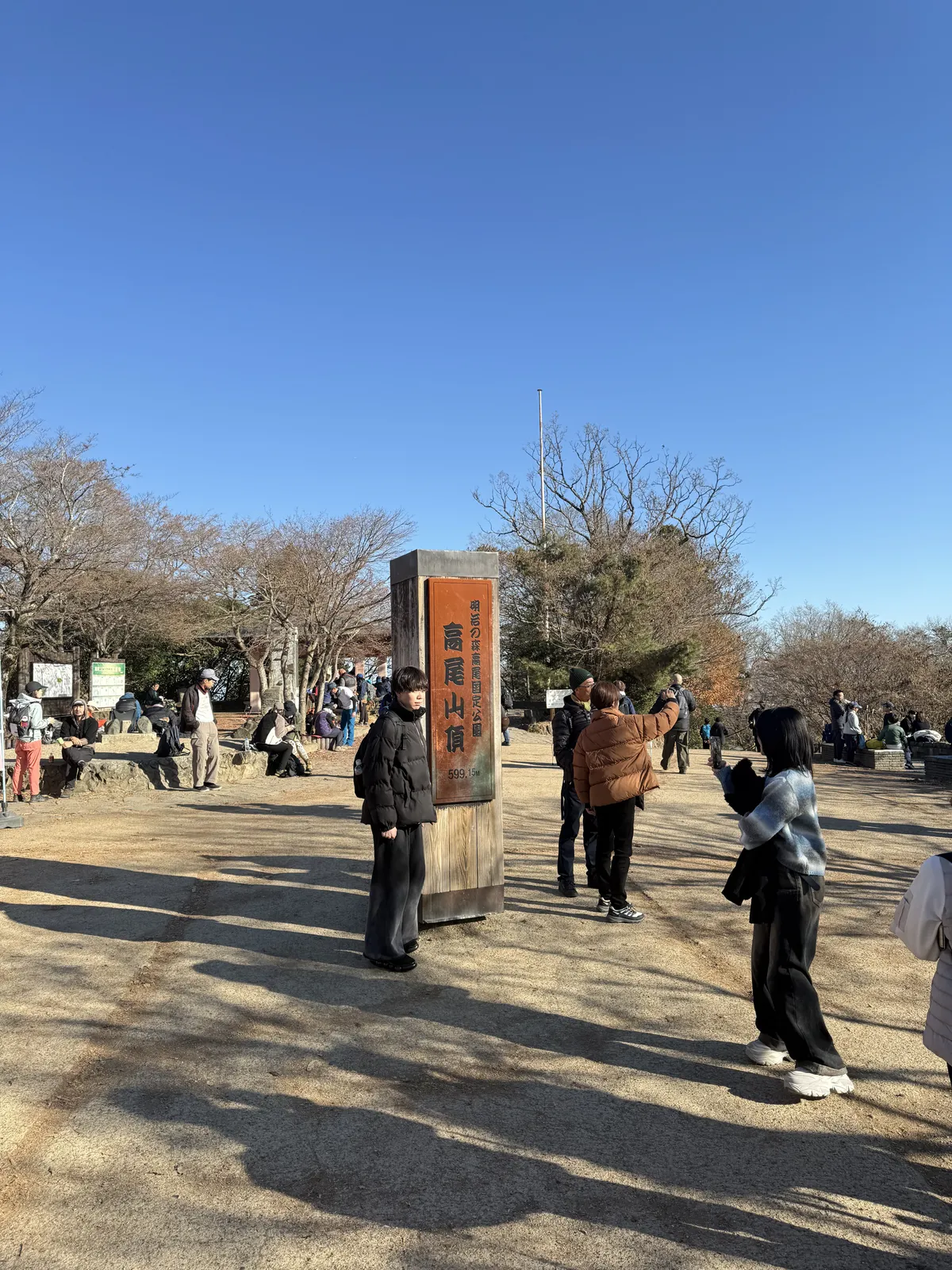
Mt. Takao (高尾山, Takao-san) stands at 599m in Hachioji City, western Tokyo. With approximately 3 million hikers per year, it holds the record as the most-climbed mountain in the world. Its greatest appeal is accessibility — just 50 minutes from Shinjuku by Keio Line, with trails starting directly from the station.
It has been awarded three stars in the Michelin Green Guide Japan, making it one of the top recommended nature experiences in Japan.
The mountain has 7 marked trails (Trails 1–6 plus the Inariyama Trail), each with its own character — from fully paved temple roads to stream-side scrambles and ridge walks.
Recommended Route: Trail 1 (Omotesando Course)
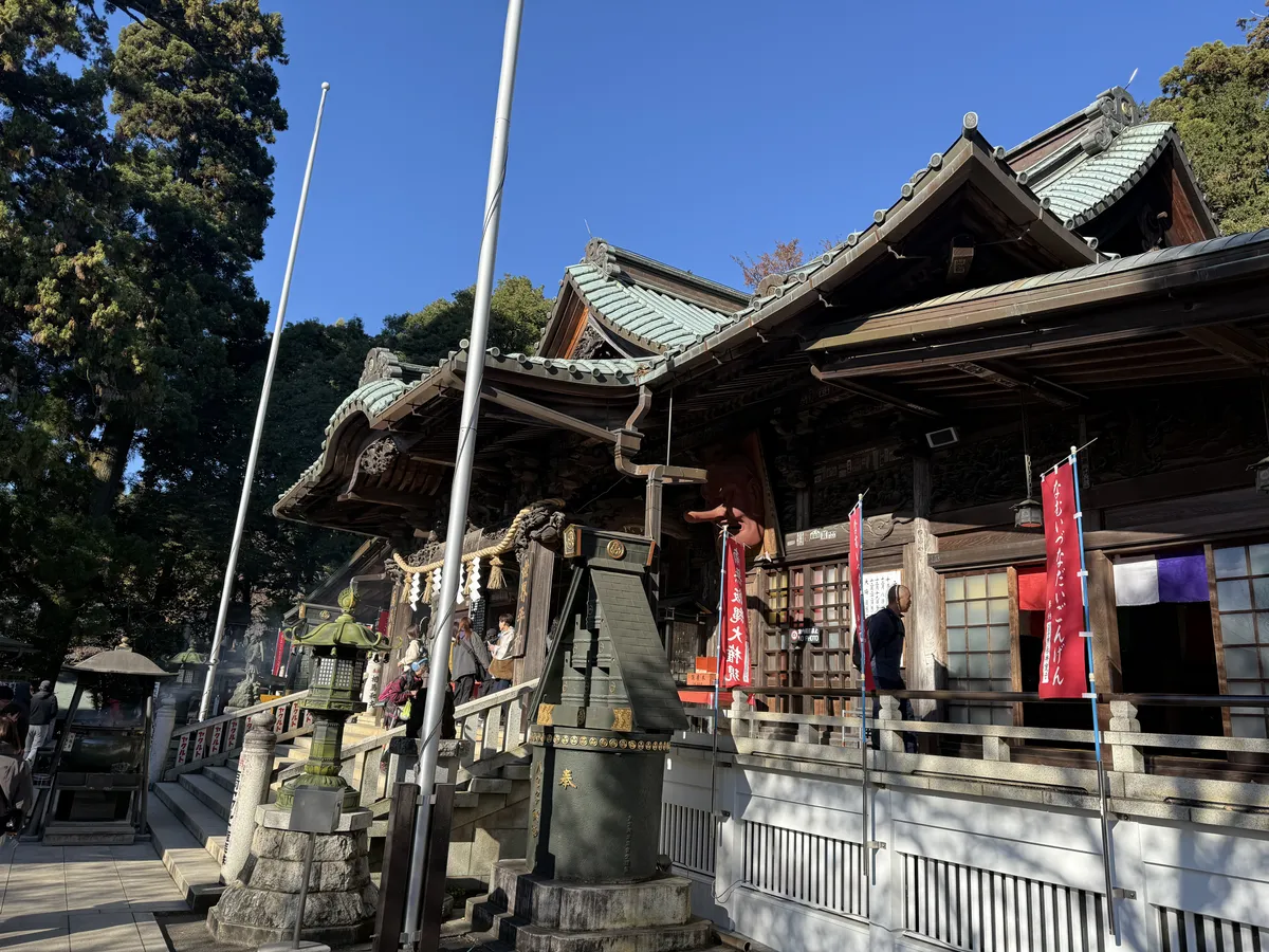
The most popular route, fully paved with wide paths.
Course Time
| Section | Duration |
|---|---|
| Takaosanguchi Station → Cable Car Base | 5 min |
| Cable Car Summit → Yakuoin Temple | 20 min |
| Yakuoin Temple → Summit | 20 min |
| Total (one way) | About 1.5 hours (on foot) |
Tip: The cable car or chairlift takes you halfway up in just 6 minutes — perfect for families with young children or those who want a shorter hike.
Trail 2 (Kasumidai Loop Course)
A short loop trail around the cable car summit station (Kasumidai). Best combined with other trails rather than hiked alone.
| Detail | Info |
|---|---|
| Distance | About 0.9km |
| Duration | About 30 min |
| Difficulty | ★☆☆☆☆ |
- The north slope features coniferous forest (fir, red pine), while the south slope has evergreen broadleaf forest (oak, chinquapin) — a fascinating contrast
- Observation deck with views toward central Tokyo
- Typically used as a connector between Trail 1 and Trail 4
Trail 3 (Katsura Forest Course)
A quiet forest trail that traverses the southern slope. Perfect for those who want to enjoy nature away from the crowds.
| Detail | Info |
|---|---|
| Distance | About 2.4km |
| Duration | About 60 min |
| Difficulty | ★★☆☆☆ |
- Walk through lush evergreen broadleaf forest
- The trail is named after a magnificent katsura tree (Japanese Judas tree) along the route
- Popular with birdwatchers due to abundant wild birds
- Well-maintained but narrower than Trail 1
Tip: This trail branches off from Trail 1 at the Joshin-mon Gate and merges with Trail 5 near the summit. For a peaceful hike, take Trail 3 up and Trail 1 down.
Trail 4 (Suspension Bridge Course)
The only trail on Mt. Takao with a suspension bridge (Miyama Bridge), running along the north slope.
| Detail | Info |
|---|---|
| Distance | About 1.5km |
| Duration | About 50 min |
| Difficulty | ★★☆☆☆ |
- The 36m-long Miyama Bridge is Mt. Takao’s only suspension bridge and a popular photo spot
- The north-facing slope is home to beech and Japanese beech deciduous trees
- Autumn foliage here is more vivid than on Trail 3
- Branches off from Trail 1 at Joshin-mon Gate and merges with Trail 5 near the summit
Note: The path can be slippery after rain or in winter. Wear sturdy shoes.
Trail 5 (Summit Loop Course)
A flat loop trail circling just below the summit. A convenient connector between other trails.
| Detail | Info |
|---|---|
| Distance | About 0.9km |
| Duration | About 30 min |
| Difficulty | ★☆☆☆☆ |
- A nearly flat path that circles the summit area
- Features the Egawa Cedar grove — massive cedar trees over 150 years old
- Junction point for Trails 3, 4, 6, and the Inariyama Course
- Great for a quiet stroll away from the busy summit area
Trail 6 (Biwa Waterfall Course)
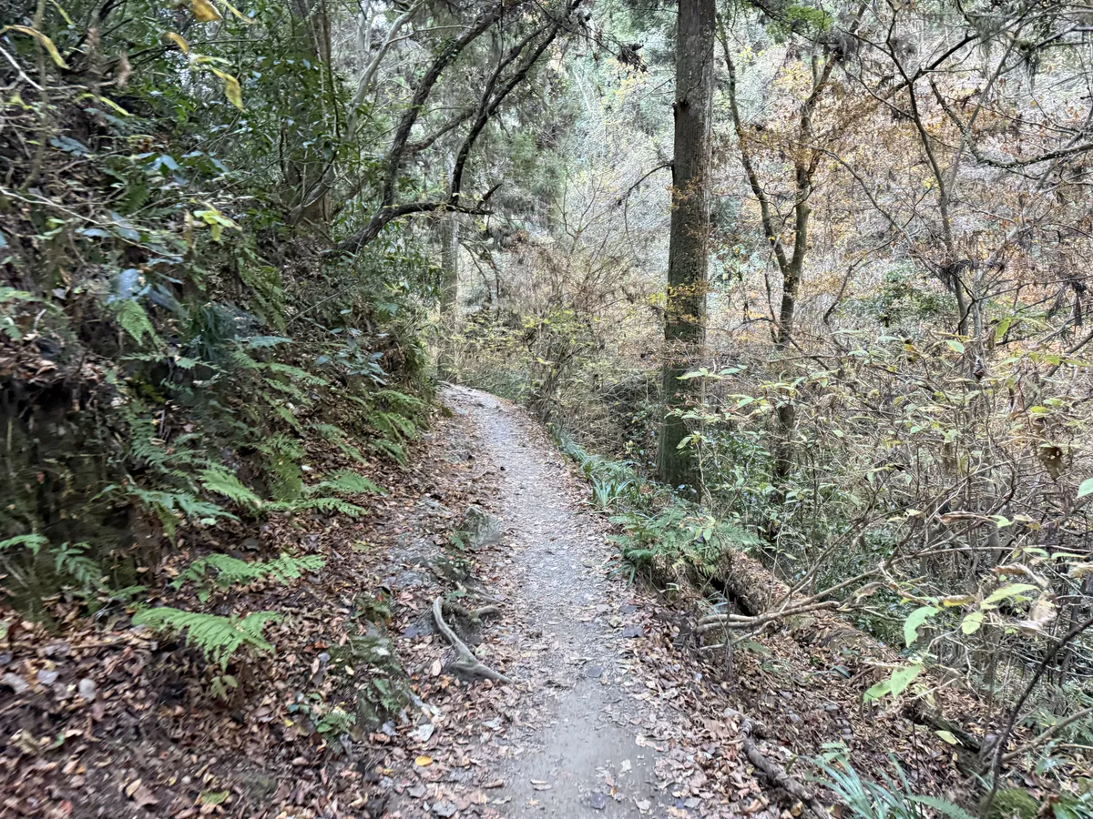
A stream-side trail offering the most authentic mountain hiking experience on Mt. Takao.
| Detail | Info |
|---|---|
| Distance | About 3.3km |
| Duration | About 90 min (one way) |
| Difficulty | ★★★☆☆ |
- Biwa Waterfall near the trailhead is a sacred site used for waterfall meditation by mountain ascetics
- The trail follows a stream, staying cool even in summer
- The upper section includes stepping stones across the stream — a fun, adventurous stretch
- A direct route from the station to the summit, second in popularity to Trail 1
Note: The stream-side trail can be slippery and water levels may rise after rain. Waterproof shoes recommended. Watch for leeches in summer.
Inariyama Trail (Ridge Route)
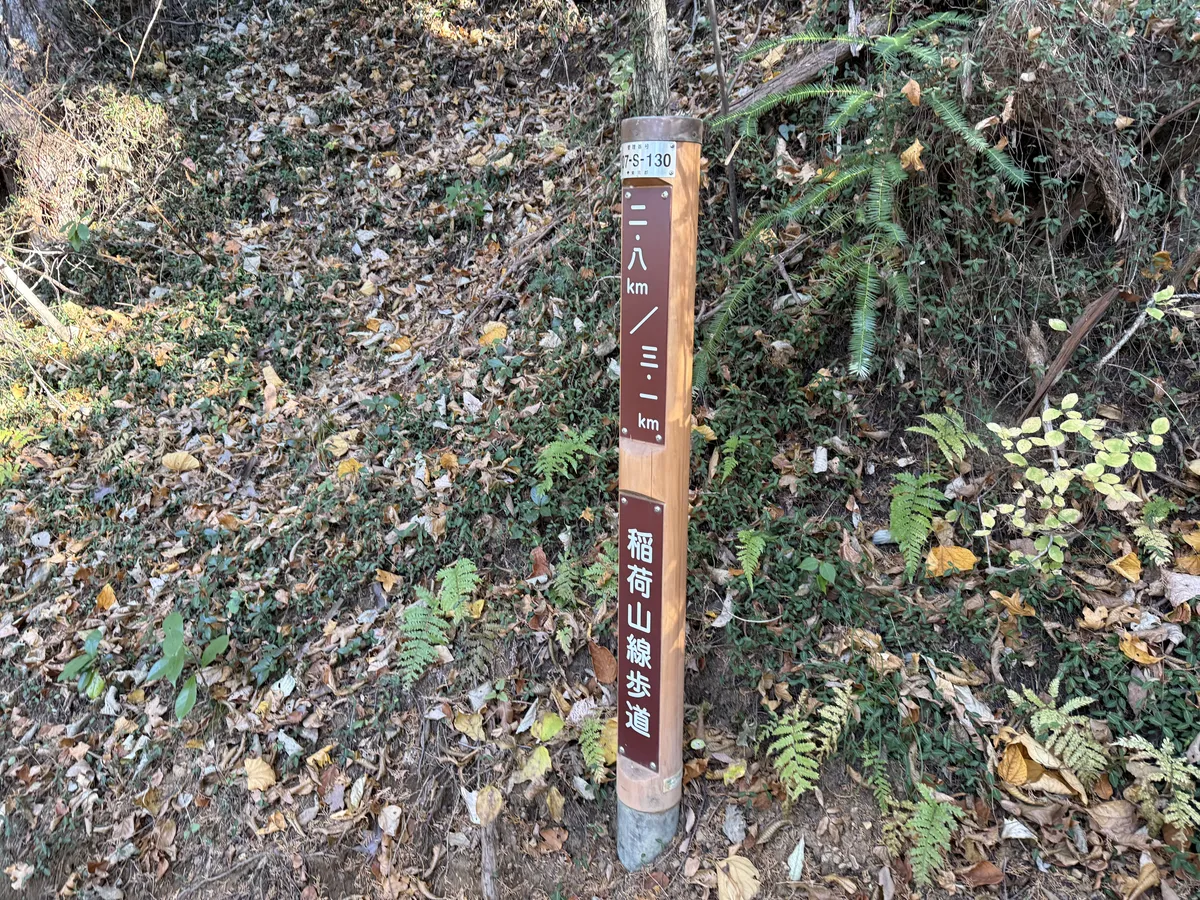
A ridge trail along the southern slope of Mt. Takao, rivaling Trails 1 and 6 in popularity.
| Detail | Info |
|---|---|
| Distance | About 3.1km |
| Duration | About 90 min (one way) |
| Difficulty | ★★★☆☆ |
- The ridge route offers excellent views, with a lookout platform (covered rest area) providing panoramic views toward central Tokyo
- A genuine mountain trail through natural forest
- Same difficulty level as Trail 6, but the ridge terrain is more stable underfoot than the stream-side route
- The trailhead is next to Kiyotaki Station (cable car base station)
Tip: For a well-balanced loop, take the Inariyama Trail up and Trail 1 (with cable car) down.
Trail Comparison
| Trail | Distance | Duration | Difficulty | Highlights |
|---|---|---|---|---|
| Trail 1 | 3.8km | ~90 min | ★☆☆☆☆ | Paved, Yakuoin Temple, beginner-friendly |
| Trail 2 | 0.9km | ~30 min | ★☆☆☆☆ | Loop, vegetation contrast |
| Trail 3 | 2.4km | ~60 min | ★★☆☆☆ | Quiet forest, katsura tree |
| Trail 4 | 1.5km | ~50 min | ★★☆☆☆ | Suspension bridge, autumn leaves |
| Trail 5 | 0.9km | ~30 min | ★☆☆☆☆ | Summit loop, ancient cedars |
| Trail 6 | 3.3km | ~90 min | ★★★☆☆ | Stream walk, Biwa Waterfall |
| Inariyama | 3.1km | ~90 min | ★★★☆☆ | Ridge walk, lookout platform |
Cable Car & Chairlift Info
Both the cable car and chairlift connect Kiyotaki Station (base) to Takaosan Station (midway, 472m).
| Cable Car | Chairlift | |
|---|---|---|
| Ride time | About 6 min | About 12 min |
| One way | ¥490 (adult) / ¥250 (child) | ¥490 (adult) / ¥250 (child) |
| Round trip | ¥950 (adult) / ¥470 (child) | ¥950 (adult) / ¥470 (child) |
| First departure | 8:00 | 9:00 |
| Last departure | Varies by season (17:15–18:30) | Varies by season (16:00–17:30) |
- Children under elementary school age ride the cable car free (one child per paying adult)
- The cable car climbs a 271m altitude difference — one of the steepest gradients in Japan
- The chairlift is open-air with great views, but operates weather permitting
Tip: On autumn weekends and holidays, expect long queues (up to 1 hour). Consider hiking up Trail 1 or Inariyama Trail and taking the cable car down instead.
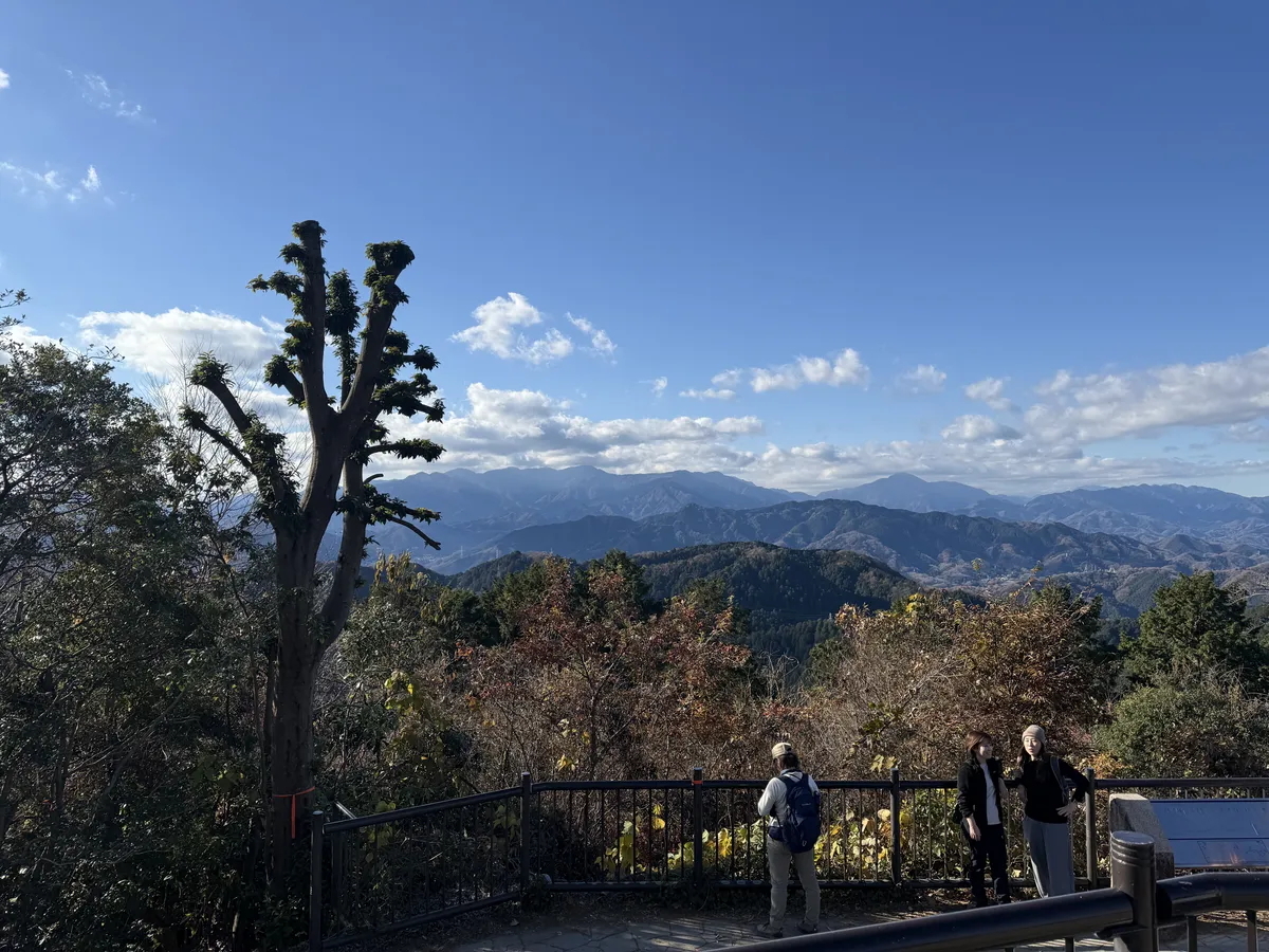
Highlights
🌸 Spring (March–May)
- Cherry blossom and fresh green tunnels
- Takao Violet, a flower species unique to this mountain
☀️ Summer (June–September)
- Mt. Takao Beer Mount (mid-June to mid-October) — an open-air beer garden at the cable car summit station
- Trail 6 follows a stream and stays refreshingly cool even in midsummer
- Lush, deep-green forest alive with cicada chorus
🍁 Autumn (November–December)
- Spectacular fall foliage across the entire mountain
- Momiji Matsuri (Maple Festival) in November
❄️ Winter (January–February)
- Crystal-clear air with stunning views of Mt. Fuji
- Diamond Fuji phenomenon (around winter solstice)
Summit & Midway Dining
Summit Teahouses
Several teahouses line the summit plaza, all serving Mt. Takao’s famous tororo soba (buckwheat noodles with grated yam) made with natural spring water.
- Yamabiko Chaya — Tororo soba, curry rice, nameko mushroom soup
- Akebono-tei — Oden (hot pot), miso dengaku
- Omiharashi-tei — Soba noodles, beer with a panoramic view
Midway (Along Trail 1)
- Juichome Chaya — Famous dango (sweet dumplings) and amazake (sweet sake), with a terrace overlooking the valley
- Gongen Chaya (near Yakuoin Temple) — Tengu-yaki (black bean paste bun shaped like Tengu’s face) is Mt. Takao’s most iconic snack
Dining Near Takaosanguchi Station
- Takahashi-ya — A historic tororo soba restaurant dating back to the Edo period. 4-minute walk from the station
- TAKAO COFFEE — Specialty roasted coffee, perfect for a post-hike café stop
Mt. Takao Beer Mount (Summer Only)
An open-air beer garden at the cable car summit station (elevation 488m), open from mid-June to mid-October.
| Detail | Info |
|---|---|
| Hours | 12:00–21:00 |
| System | 120-minute all-you-can-eat & drink buffet |
| Price | Adult ¥5,000 / Senior (65+) ¥4,700 / Elementary school ¥1,800 / Preschool ¥500 |
- Cable car last departure extended to 21:15 during Beer Mount season
- Spectacular night views of the Kanto plain while enjoying beer at altitude
Post-Hike Hot Spring
♨️ Keio Takaosan Onsen / Gokurakuyu
A day-use hot spring directly connected to Takaosanguchi Station — just 1 minute from the ticket gates.
| Detail | Info |
|---|---|
| Hours | 8:00–22:30 (last entry 21:45) |
| Adult price | ¥1,100 (weekday) / ¥1,300 (weekend & holidays) |
| Child price (ages 4–12) | ¥550 (weekday) / ¥650 (weekend & holidays) |
| Water type | Alkaline simple thermal spring |
- Outdoor baths (hinoki cypress, rock), indoor baths, carbonated bath, and sauna
- On-site restaurant serving soba, beer, and seasonal dishes
- Parking for about 90 cars (3 hours free with Gokurakuyu admission)
- Gets extremely crowded during autumn foliage season — arrive early for the best experience
Access Information
- Nearest Station: Keio Line, Takaosanguchi Station (50 min express from Shinjuku)
- JR Chuo Line: Transfer at Takao Station to Keio Line (1 stop)
- Parking: Paid parking available near the station (crowded on weekends)
Important Notes
- ⚠️ Extreme crowds in autumn: On November weekends, expect 1-hour waits for the cable car and congested trails. Start early (before 8 AM)
- ⚠️ Leech warning: Leeches appear on Trail 6 and Inariyama Trail in summer. Bring leech repellent spray or salt
- ⚠️ Winter ice: From December to February, upper sections of Trail 6 and Inariyama Trail may be icy. Light crampons recommended
- ⚠️ Watch the sunset: Trails other than Trail 1 have no lighting — plan to descend well before dark
- 🚻 Restrooms: Available at the base, cable car summit station, Yakuoin Temple, and the summit. Well-maintained
Packing Checklist
- ✅ Comfortable walking shoes (sneakers are fine for Trail 1)
- ✅ Water bottle (also available at summit)
- ✅ Towel
- ✅ Rain gear (a folding umbrella works)
- ⬜ Waterproof hiking shoes (recommended for Trail 6)
- ⬜ Leech repellent spray (for Trail 6 in summer)
Related Articles
- Mt. Jinba — Take the Next Step Beyond Mt. Takao — Can be reached by ridge walk from Mt. Takao. White horse statue and 360° panorama
- Mt. Kobotoke-Shiroyama — Midpoint of the Takao–Jinba Traverse — Famous nameko mushroom soup at the summit teahouse
- Mt. Kagenobu — Summit Teahouse & Grand Views — A hidden gem in the Takao area
- Mt. Sekirozan — Mossy Boulders & Forest Walking — Intermediate trail along the Chuo Line
- Chuo Line Green Car Guide — Travel to Mt. Takao in comfort
- Suica Complete Guide — One card for all trains and buses